Project Need
Coastal and Stormwater Flooding
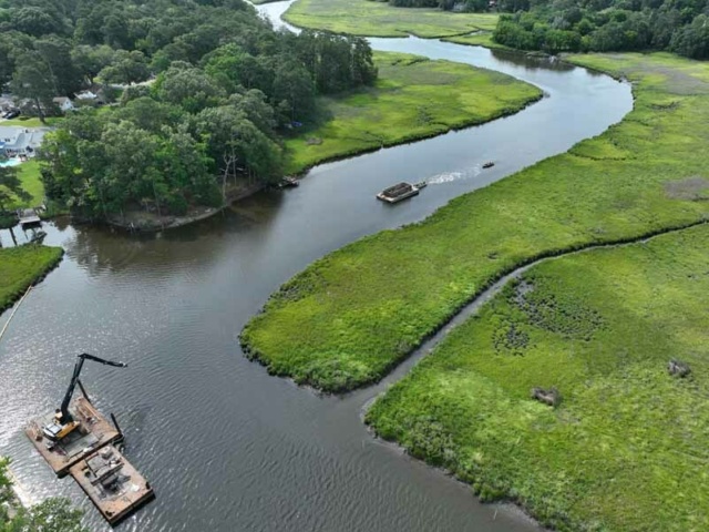
The Eastern Branch of the Elizabeth River is the key flood entry point into the Elizabeth River watershed. Tidal creeks extending from the main stem of the river connect neighboring properties to the water. During storm events, the elevation of the river can increase by several feet.
Flooding of low-lying lands can be much worse when high tide, strong coastal wind-driven storm surges, and heavy or extreme rainfall occur simultaneously.
Erosion and Ecological Decline
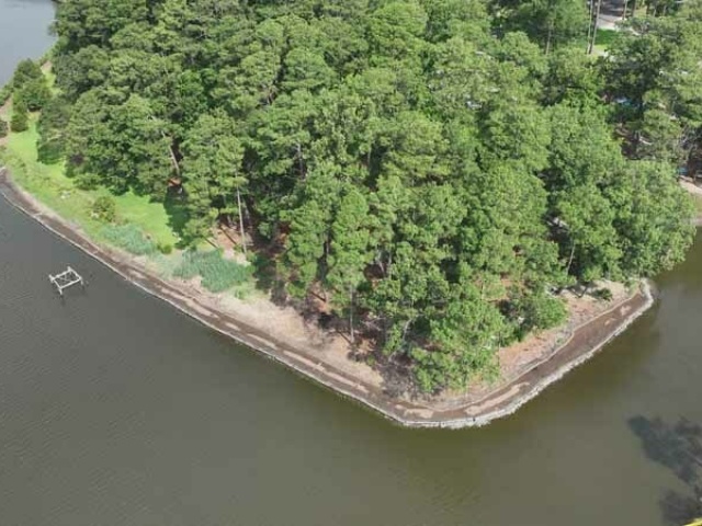
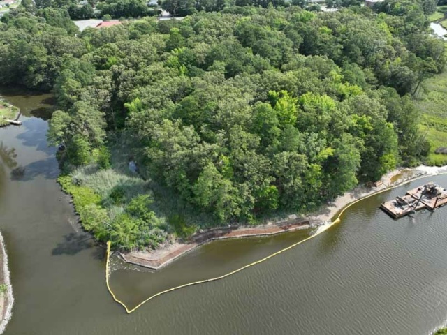
Historical analysis has revealed that over the past 50 years, development surrounding the river has led to degradation of the marsh system. The City’s future condition modeling predicts continued erosion of tidal marsh along the Eastern Branch, resulting in conversion of healthy marsh into open water and mud flat.
Design Toolkit
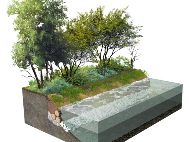
High Marsh Protection
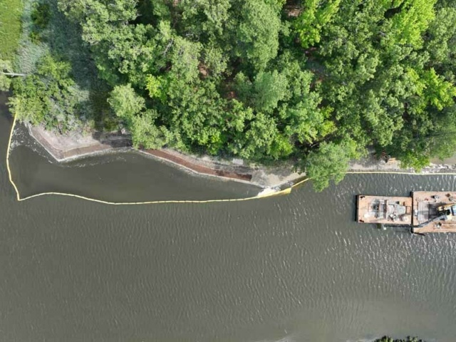
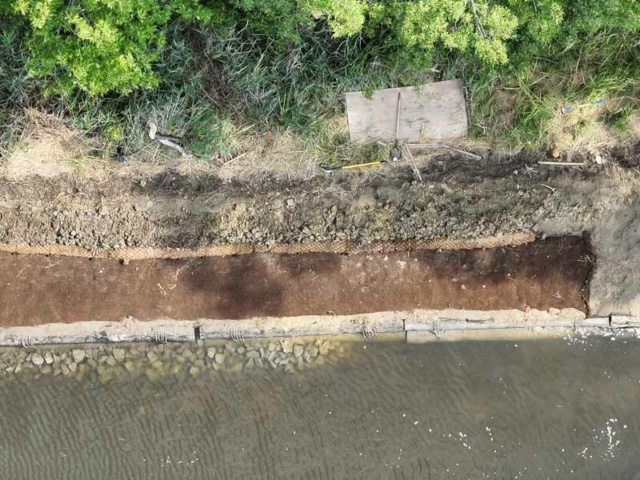
High marsh protection is proposed along the shoreline where there is existing marsh. This protection consists of a coir log installed at the edge of the existing marsh, hardwood logs below the high tide line, and marsh plantings in the area between the coir log and hardwood logs.
The coir log will eventually disintegrate, and the native wetland vegetation will take its place, acting as a shoreline buffer. These mitigation tools will work to stabilize and restore the riverbank. Vegetation will grow up and around the coir logs, eventually creating living shorelines.
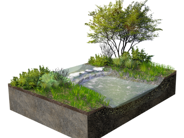
Upland Protection
Upland Protection is proposed for areas where the shoreline consists of vegetation or banks that are not marshland.
This shoreline protection will be installed with hardwood logs set below the high tide line, a coir log along the top of the bank and a vegetated armor mat as stabilization for the area between the coir log and hardwood logs.
The coir log will eventually disintegrate, and vegetation will grow creating living shorelines.
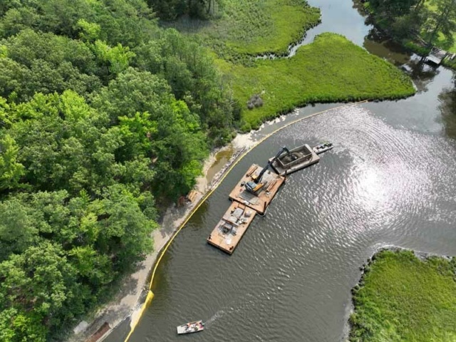
Ditch Stabilization
It is necessary to stabilize the channels/ditches that drain water from the developed areas surrounding the river to support the installation of living shorelines along the river. Stabilizing these ditches will help provide additional storage capacity and provide erosion protection of the restored shorelines. The existing stormwater ditches along Normandy Avenue will be pools.
The proposed design features will work together to reduce erosion of the tidal marsh, improve water quality, and reconnect floodplain wetlands for improved riparian habitat and flood mitigation.